
Q&A Zoom meeting Youtube videos with MoRP's at the bottom--Scroll
Books about paddling on the Missouri River:
The list of books below and their links will help you in the preparation of your adventure. Many of the MoRP members have written books about their journey, and are a must read. Here's the list below.
Books about paddling on the Missouri River:
The list of books below and their links will help you in the preparation of your adventure. Many of the MoRP members have written books about their journey, and are a must read. Here's the list below.
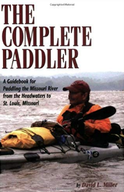
THE COMPLETE PADDLER:
By David Miller. THE BIBLE on paddling the entire Missouri River system! A must read if you plan to paddle any or all of the river: Every thru-paddler since 2006 has carried a copy of this book with them. Get this!
Do not order from Amazon as they are price gouging. There are many copies of the guidebook available to borrow or obtain from MoRP members.
Please contact the moderator for details. EMAIL
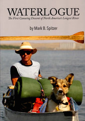
NEW BOOK 2023!
Waterlogue: The First Source to Sea descent account published Oct-2023! Mark Spitzer and his dog Groucho descended the Missouri river system in 1989 from it's utmost source at Brower's Spring and followed the course to the Gulf of Mexico. This was the first descent of North America's longest rivers system and long before the cell phones and the internet. A must read book!
Get your copy by clicking this link. BuffaloCommonsPress

Out My Backyard: This book, written by Jim Kurz can be yours for $10 which includes shipping. All proceeds go to help maintain this website, and to create a memorial/tree planting in honor of Kurz who tragically died on the Missouri River June 9, 2023. In 2005 Jim paddled from Wisconsin and UP the Missouri river to Three Forks, Montana and wrote this book. It is full of photos and a day to day account of his journey by canoe with his dog Daisy.
Email, the moderator to get a copy of this book. Thanks for your support. Email
Email, the moderator to get a copy of this book. Thanks for your support. Email
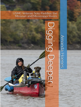
Digging Deeper: by Amanda Hoenes
In 2021, Iraq War Veteran Amanda Hoenes and her dog Hank canoed solo from
Three Forks, Montana to the Gulf of Mexico. Hoenes had no prior canoeing experience before her departure. This book is a collection of stories and photos of her 3500 mile descent.
You can purchase a copy of her book on Amazon at: Book
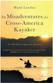
The Misadventures of a Cross-America Kayaker: by Hank Landau: The Misadventures of a Cross-America Kayaker is the story of an old man on what would probably be his final adventure. Over a span of seven years, Hank Landau paddled and portaged over 4,700 miles on nineteen waterways and rivers, six of them going upstream. He touched seventeen states and traversed thirty-one dams along a route that started at the Pacific Ocean and ended at the Atlantic. Alone almost the entire trip, and always under his own power, age and injuries took their toll. Paddling over a diversion dam, run-ins with a charging alligator and a rattlesnake that pursued his kayak, almost being run down by tows and barges, being swept out to sea at an inlet, capsizing in rapids, and becoming lost in a swamp as fire ants invaded his cockpit were some of the perilous, life-threatening, and sometimes humorous misadventures he encountered along the way. He also had ample time to reflect on the accomplishments of early explorers, including those of the Lewis and Clark Expedition, whose route he followed west of the Tennessee River. Not a day went by that he didn't reflect on the beneficial and detrimental impacts civilization has brought to our rivers and waterways and to the people who now live and once lived along their shores. To purchase Hank's book, please click the link: Book
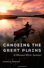
"Canoeing the Great Plains", by Patrick Dobson-- Winner of the High Plains Book Award and Thorpe Menn Award! Tired of an unfulfilling life in Kansas City, Missouri, Patrick Dobson quit his job and set off on foot across the Great Plains. After two and a half months, 1,450 miles, and numerous encounters with the people of the heartland, Dobson arrived in Helena, Montana. He then set a canoe on the Missouri and asked the river to carry him safely back to Kansas City, hoping this enigmatic watercourse would help reconnect him with his life. As the miles float by and the distinctions blur between himself and what he formerly called nature, Dobson comes to grips with his past, his fears, and his life beyond the river.
Patrick's Book Here
Patrick's Book Here
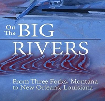
"On The Big Rivers" , by Richard E Messer--Glad to have Richard in our group. This 2015 book is about he and Jerry Sanders 1962 canoe trip from Three Forks, Montana to New Orleans! Travel with them in a time before cell phones and GPS as they are initiated into the age old perils of nature and explore the historic river towns along their route. Experience through vivid, first person story telling, the physical and emotional challenges they meet and overcome in their encounters on this pioneering journey down the two greatest rivers of America. There's a video interview with Richard about his trip and book at the bottom of this page.
Richard's Book
Richard's Book
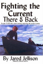
Fighting The Current There and Back", By Jared Jellison. A true life story about two ordinary guys who embarked on an adventure of a lifetime that challenged their strength & endurance, as they paddled across America in canoes. Two and a half years & 8,000 miles later, they finished the epic journey gaunt, exhausted & feeling a huge sense of accomplishment. Their final 2000 miles was down the Missouri river back to their home.
Free Online Ebook and Hard Copy Here:

Online guide by Keith Drury on paddling the entire Missouri River:
One of the 1st online resource guides.
Keith's Online Guide Here

"A Paddle Across America", by Richard Silvestri . Over the course of 3 summers, Richard Silvestri kayaked from the Atlantic to the Pacific including an upstream ascent of the Missouri river. This is a book about planning, near obsession, and shear determination to beat the odds of succeeding. It is a story about inner drive that culminates in success.
Richards Book Here:
Richards Book Here:

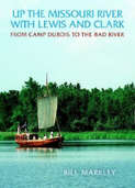
"A Current Adventure- In the Wake Of Lewis & Clark", by Chris Bechtold. In April of 1998, Chris Bechtold and his faithful dog Herschel embarked on the trip of a lifetime. Inexperienced with boats or big rivers and laden with minimal provisions, the two travelers set out with an abundance of determination to retrace the westward journey of Lewis and Clark. Starting at Camp Dubois, Illinois on the shore of the Mississippi River and culminating at the Pacific Ocean on the Oregon Coast, Bechtold traveled over 3,100 miles in a fourteen-foot boat to search out the untamed West.
Chris' Book Here:
Chris' Book Here:
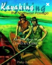
"Kayaking the Northwest Passage--Along the Route of Lewis and Clark", by Philip Babiak . This journal reports the details of the 82 Day Journey of Discovery that Philip Babiak and Bob Witt took from Williston, North Dakota to the Pacific Ocean along the route of Lewis and Clark. Babiak writes--“If there’s one thing I’ve learned on this trip, it’s the realization of my need for good people. . .Happiness depends on the people you are with. You, by yourself, are very empty. You must have people, but they must be good people."
Philip's Book Here Online:
Philip's Book Here Online:

"Wake of the Wind Dancer", by Karl Adams: He followed or closely paralleled the path of seven of America's early explorers; Lewis and Clark among them. He is the only person known to have covered this entire route by boat and on foot, with no support team or power other than the energy supplied by his own body. Astoria, Oregon to Miami, Florida. (First modern day crossing of North America by kayak--Included his descent down the Missouri river!)
Karl Adam's book here:
Karl Adam's book here:

"The Ultimate Canoe Challenge - 28,000 miles Through North America By Paddle",
by Verlen Kruger and Brand Frentz: The longest paddle expedition ever undertaken. For 2- 1/2 years Verlen Kruger and Steve Landick paddled 28,000 miles all over N. America, including a 33 day descent down the entire Missouri River!
Order Book Here:
by Verlen Kruger and Brand Frentz: The longest paddle expedition ever undertaken. For 2- 1/2 years Verlen Kruger and Steve Landick paddled 28,000 miles all over N. America, including a 33 day descent down the entire Missouri River!
Order Book Here:
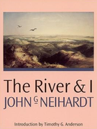
The River and I", by John Neihardt: In 1908 John Neihardt and two companions traveled the Missouri River—about two thousand miles—in a twenty-foot canoe. The River and I describes their adventures on that wild waterway before it was dammed by the Army Corps of Engineers and points out storied sites along the shore. The result transcends journalism; Neihardt does for the Missouri what Twain did for the Mississippi.
Order Book Here:
Order Book Here:
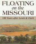
"Floating the Missouri", by James Schultz: A true story about Schultz and his Blackfoot wife Apikuni who take a float down the Missouri river in 1901! A classic must read!
Order Schultz's book here:

"The Missouri River Odyssey-1939" by Bob & Louise Lynd-- This is a fantastic account of canoeing from Ft. Benton to New Orleans in 1939! A must read!
Order the Lynd Book Here:
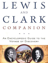
"The Lewis & Clark Companion- An Encyclopedia Guide to the Voyage of Discovery", and "Why Sacagawea Deserves the Day Off and Other Lessons from the Lewis & Clark Trail", by Stephenie Ambrose Tubbs. Stephenie has probably paddled through the Missouri Breaks in Montana more than anyone in our group. Her earliest times on the Missouri river were with her late father Stephen E. Ambrose the author of "Undaunted Courage" and "Band of Brothers".
L&C Companion: Order Here:
Why Sacagawea Deserves the Day Off: Order Here:
L&C Companion: Order Here:
Why Sacagawea Deserves the Day Off: Order Here:

Mississippi Madness, By Nicholas Francis: Francis makes a mad dash down the Missouri river to the Gulf in this early historic descent book.
Order Book Here:

The Missouri River: by Leon Gray: Looks at the longest river in North America, discussing the history, geological features, wildlife, and the importance of the river to those who live nearby.
Order Book Here:
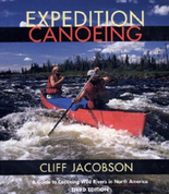
Expedition Canoeing: By Cliff Jacobson:
The Bible for Expedition paddling anywhere.:
Cliff's Book Here:

People of the Troubled Waters: by Nancy Peterson: Great historical journals of the Missouri river from 1670-1853. If you like history and want to know what happened along the Mo:
Order Book Here:
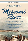
A History of the Missouri River- First published before 1920's. Good account of the early
history on the river. By Chappell---A Must Read!
Order Book Here:

Fur Traders, Trappers, and Mountain Men of the Upper Missouri by Leroy Hafen
Detailed accounts of early Euro travel and exploration on the Missouri River.
Order Book Here:

History of Early Steamboat Navigation on the Missouri River by H. Chitteneden.
Amazing history of the Missouri River's steamboat era.
Chittenden's Book Here:
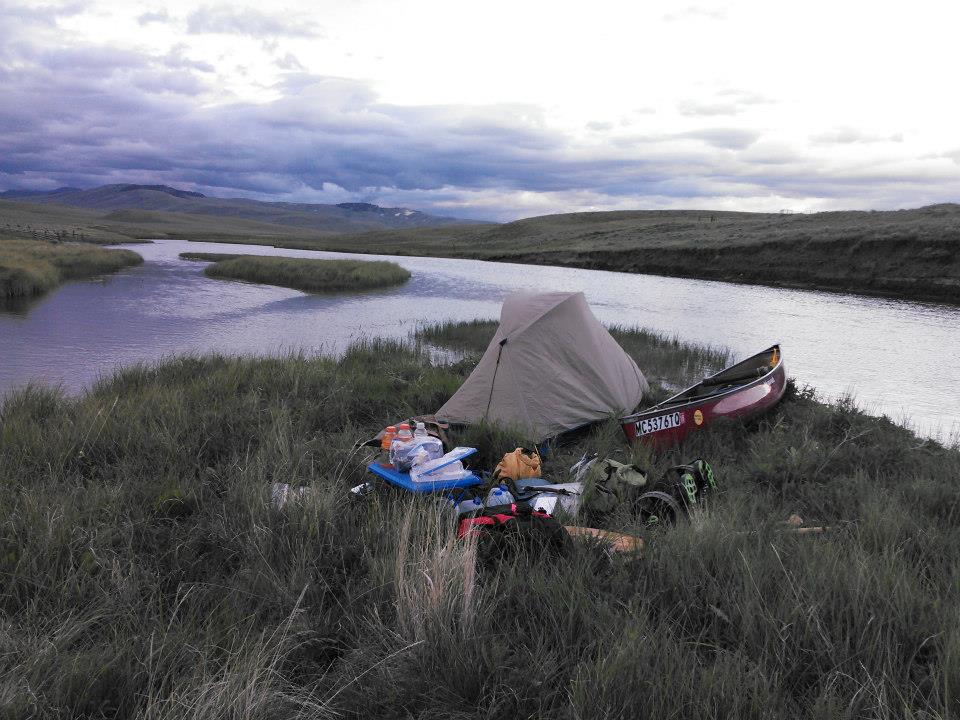
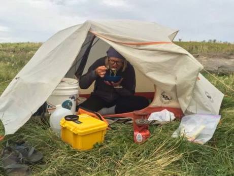
Camping: Don't expect ideal beautiful camps the entire way to St. Louis. You will have to be flexible in your choices. There is no "ideal" location. At times you will have to pitch your camp with limited space. Most paddlers like the isolation away from towns, boat ramps, railroad tracks, and noisy people locations in general. Stealth camping is a common practice among long distance paddlers (LDP). Setting up camp late and taking it down early in the morning long before anyone knows you are there is common practice. The biggest complaint heard among LDP's, is they made the mistake of camping too close to public access sites. These places are popular late night party spots for high school kids drinking beer and playing loud music.
Occasionally there are areas of private property in which you will want to respect and stay away, or ask permission from the land over if possible. Other times, you may discover an established campground with water, picnic tables, showers and a store. Many LDP's contact River Angels who enjoy helping paddlers. A paddler is often treated with a warm bed, hot shower, laundry, a good meal, cold beverage and whatever else they may need. Every paddler has their own intention and specific plan. I suggest you let the adventure unfold, rather than "plan" in details. There is no way to know where you will be each evening, so save your time and energy and focus on some other aspect of your planning. I suggest taking notes or writing information you learn and discover in Dave Miller's guide book--The Complete Paddler. Reading the blogs and websites of past expeditions you can jot down some of the places they said were good camps or places to avoid.
NEW (Feb 13, 23) - Details of Dave Hillmans 2022 Camps and Notes from his Montana to Gulf Trip.
(Worth printing and making your own notes.)
CAMP Locations/Details
Camps with GPS
Dave's thoughts and comments on trip.


Maps: Various links to map resources.
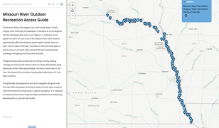
Nebraska Outdoor Mo River Guide: This guide shows public access sites for boating and camping and more on the Missouri River as it flows downstream along Nebraska's border. There are approximately 160 sites on both sides of the river. This guide was also designed as source for navigation along the river. The map offers site spatial proximity to cities and other sites, as well as river mile markers and boat ramps in case of emergency. Click Image.
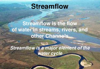
Stream Flow Charts: Current conditions and historical comparisons. See how fast and strong the river is from various locations.
USGS Montana Stream Flows: Click the photo to the right to access the Upper Missouri river and all the major tributaries such as the Gallatin, Madison, Jefferson, Maria's, Sun, Mussellshell, Milk and Yellowstone Rivers.
USGS Montana Stream Flows: Click the photo to the right to access the Upper Missouri river and all the major tributaries such as the Gallatin, Madison, Jefferson, Maria's, Sun, Mussellshell, Milk and Yellowstone Rivers.
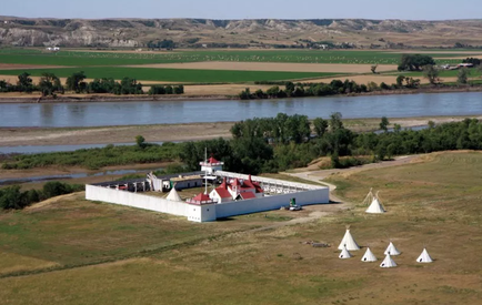
Ft. Union National Historic site is a must see while paddling down the Missouri. It was the world headquarters for the American Fur Trade Company in the early 1880's. It is just upstream of the confluence with the Yellowstone River. MoRP member, Jeff Brown has provided a pdf map link which you should download. It is extremely difficult to access the fort from the river without this map.
Click Downloadable pdf river access map by Jeff Brown.
Click fort image for map of fort area and information.
Click Downloadable pdf river access map by Jeff Brown.
Click fort image for map of fort area and information.
The Missouri River Water Trail has some great maps and information pertaining to the river through the state of Missouri. Lots of great info here. Click the image to the left to access the site.
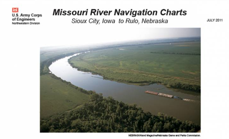
This massive 135-page pdf contains every mile between Sioux City, Iowa to Rulo, Nebraska and shows all 10,000 wing dikes. These maps are extremely useful. They are a must for anyone paddling UP the Missouri for their locations of each wing dike in which you will need to paddle around. These are put out by the U.S. Army Corps. of Engineers
Click the Map Image to download the huge file. There are several formats.
Click the Map Image to download the huge file. There are several formats.
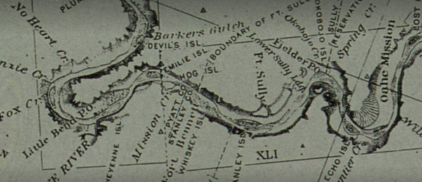
Here are a set of some amazing maps, pre-dams and Corps. of Engineers, showing original river channels. Published by the Missouri River Commission in 1892-1895 on eighty-four sheets plus nine index sheets. With this mapping expedition, “modern mapping had arrived, and the river was now mapped with precision from its mouth to Three Forks.” “Later mapping made only minute improvements on these maps, principally in recording its ever-changing channel and in documenting the destruction of the river as a free-flowing natural stream in the post-World War II period” (Wood 1984). Amazing!
Click Image above for link
Click Image above for link
Missouri River Miles Coordinates.
Missouri River Miles, 5 mile intervals,
UTM Coordinates, WGS84 Datum
Obtained from Dave Miller in 2007, created by John Sullivan.
Great to download for your records. Click Image to the Right to download.

Ft. Peck Reservoir. Detailed USACE aerial photos from Fred Robinson Bridge (Kipp Landing) to Ft. Peck Dam. Here is 20+ maps to download or click to view. (download copies to your phone for your trip!)
Lake Sakakawea Maps- Download QR Code to save each section to your photo or pc.

Lake Sharpe- This 90-mile reservoir is part of the Missouri river in Central South Dakota.
Detailed maps below. Click each to download or view.
Map 1, Map 2, Map 3, Map 3A-Dam, Map 4, Map 5,
Map 6, Map 7, Map 8, Map 9, Map 10, Map 11
David Forbes camp locations from Three Forks, Montana to St. Louis.
A great tool for paddlers!!!
This gives you a lot of ideas as far as judging locations, distances and more.
A very useful tool and great way to see aerial photos of camp locations! It helps to
make note of these camps on your own maps in case of emergency and need to get off the water
due to weather. Having info on known previous camps by paddlers is helpful.
CLICK DAVE'S IMAGE to download this file.
Sara Dykman: Audio Interview- Source to Sea- Triple Divide Peak to the Gulf of Mexico.
Here is a must listen to interview with adventurer Sara Dykman, as she talks about descending the Missouri river system from Triple Divide Peak in Glacier National Park to the Gulf of Mexico. Sara talks about the logistics, challenges and day to day life on the Missouri River.
A must listen! CLICK HERE:
Audio Interview with Dale Waldo - Solo - Brower's Spring to St. Louis - 56 days by canoe!
These were originally downloaded on Facebook. Two Part Audio.
Part 1: Click Here:
Part 2: Click Here:

A 2015 interview with author Richard Messer regarding his 1962 canoe descent from Three Forks, Montana to New Orleans with Jerry Sanders. Richard published his account 50 years after the great expedition. His book, "On the Great Rivers", is a must read.
Check out this audio interview with him on Youtube. Click Here:
Audio interview with Canadian, Martin Trahan upon completion of his cross-country paddle expedition from Oregon to Florida. This interview was recorded moments after he arrived in Key Largo.
Click here:

Thinking about doing a food drop?
Many of the MoRP expeditions have sent packages to various post offices along the route. Paddlers should carry about 2-weeks' worth of food to get them to the next town. The upper Missouri river is limited on town access, while the lower Missouri has more access to large towns such as Omaha, Yankton, Sioux City. If you plan your expedition wisely, you can reach available towns to purchase goods, supplies, and food. However, take note than some of these smaller towns may not have the variety of food that you need or were hoping to find. If you have a special diet need, then consider having certain items shipped to you. If you start at Three Fork, Montana, two weeks' worth of food should easily get you to Great Falls and/or Ft. Benton. Great Falls is a very large city, but the grocery stores are not close to the river. In Ft. Benton, there is a small community grocery a block from the river. It is highly recommended that you carry about 2-weeks of food when leaving Ft. Benton, since there is no towns or services until you get to Ft. Peck. Once you arrive at Ft. Peck, the town and grocery's are very limited. A few small gas station type stores provide a minimum variety of food. You should consider sending food to the post office in Ft. Peck or take a little extra when leaving Ft. Benton and push the extra miles to either Culbertson, Mt or Williston, ND. (It is not recommended to stop/shop/or hang out along the Sioux Reservation in the towns of Wolf Point, Poplar, and Brockton)
River Angel, Peggy Hellensaas, owner of Tobacco Gardens on Lake Sakakawea has helped paddlers by using her business as a food drop for shipping items. Once you leave Culbertson or Williston, you should have another two weeks of food to get you to Washburn or Bismarck, ND.
Below is a recommended list of U.S.Post Offices close to the river where food and other items can be shipped. When shipping a box to yourself, there are a few things to consider. The post offices ONLY holds packages for 30-days which are then sent back. Plan your shipments accordingly. You may want to drop a brief email to the postmaster telling him about your package and your journey. When shipping to yourself, all you need is your name, the words "general delivery", the town and zip code. (In the bottom left corner some paddlers have added their expedition name as a reminder that you are a river traveler and not the average person passing through town. A few other things to consider is that post offices are closed on holidays, most weekends, and by 5p.m. So don't get caught needing food and arriving at 5:10pm on Friday when they are closed and realizing it's a 3 day holiday weekend and you have to wait until 9am the following Tuesday!
- Each link contains office hours, a map location in relation to the river, phone numbers and the nearest alternative post office.
- Three Forks, Mt: Post Office: Click Here
- Cascade, Mt: Post Office: Click Here:
- Ulm, Mt: Post Office: Click Here:
- Great Falls, Mt: Post Office: Click Here:
- Ft. Benton Post Office: Click Here
- Ft. Peck, Mt: Post Office: Click Here:
- Culbertson, Mt: Post Office:
- Williston, ND: Post Office:
- New Town, ND: Post Office:
- Riverdale. Garrison Dam, ND: Post Office:
- Washburn, ND: Post Office-Recommended
- Bismarck, ND: Post Office- One of several options:
- Mobridge, SD: Post Office:
- Pierre, SD: Post Office:
- Ft. Pierre, SD: Post Office:
- Chamberlain, SD: Post Office:
- Pickstown, SD-Ft. Randall Dam: Post Office:
- Yankton, SD-Post Office: NOT RECOMMENDED--A long ways from the river.
- Sioux City, Iowa- Main Post Office:
- Decatur, Nebraska: Post Office:

RiverGator: Those who are planning on continuing to the Gulf of Mexico, should connect with all the resources created by John Ruskey of the lower Mississippi River. John has mapped all of the river from St. Louis to the Gulf of Mexico. John is a well-known legend on the Mississippi River. John has probably helped out more through-paddlers than another other person. Click the logo above to reach this detailed paddling resource.
Video Links: There are hundreds of videos out there to help aid your planning, provide inspiration or answering questions. Here are a few videos by members of the MoRP, including interviews as well as Q&A's with those that have paddled the entire river.
There is a 200 page Q&A with 40 paddlers who have done the entire river here on this website---
click Q&A to be directed to that page.
March 18, 2024 ZOOM Q&A: Our first of the year. Great attendance and questions despite a few technical problems. Very informative Q&A with paddlers headed out in 2024.
The first-ever zoom Q&A with Missouri River alumni with paddlers about to set out.
Lots of great information if you are planning a trip down the Missouri river.
Lots of great information if you are planning a trip down the Missouri river.
Part 2- Missouri River Paddlers Q&A. A wealth of information.
Below: 2023 Q&A with past alumni and future long distance paddlers. These Q&A's have been really helpful in planning your trip.
Below: March 2022 Q&A. More wealth of information on paddling the entire river.
BELOW: Dave Hillman's Part-1: Three Forks to the Gulf of Mexico presentation. Dave solo kayaked from Montana to the Gulf in 2022. Here is his presentation and Q&A. A wealth of information.
Part-2: Dave Hillman's Montana to the Gulf solo kayak expedition in 2022.
Below: Interview with Kris Laurie in 2016 who made the 2nd canoe descent from the utmost source of the Missouri river at Brower's Spring to the Gulf of Mexico. Kris is one of only 12 others known to have accomplished this journey. This interview is live from the Jefferson River about a week into Kris's journey. It was raining and temperatures were hovering in the high 30's when we met up with Kris and his cousin at Shoshone Landing on the Jefferson River. A wealth of information if you plan to start at the "Source".
Below: 2015 Interview with Richard Messer and his 1962 expedition from Three Forks, Montana to the Gulf of Mexico. This was recorded the same year Richard published his account of the trip in the book- "On the Great Rivers". Scroll above to the books, to purchase Richard's book.
Below: Part 1: Janet Moreland- 2013 Source to Sea of the Missouri River.
She made the 1st descent by a woman of the longest river on the continent.
She made the 1st descent by a woman of the longest river on the continent.
Part 2: Janet Moreland: Source to Sea of the Missouri River system.
Below: A PBR Moment with Janet Moreland. After a week of paddling from the Source of the Missouri, we meet up with Janet at Three Forks, Montana, where she talks about the journey so far. Informative and oft times humorous.
Below: Janet wins Canoe & Kayak Magazine's, Spirit of Adventure award for her expedition.
Here is the event and acceptance speech by Janet.
Here is the event and acceptance speech by Janet.
Below: 2013 Interview with Janet Moreland, the day she made history by
becoming the first woman to travel Source to Sea of the Missouri River system.
becoming the first woman to travel Source to Sea of the Missouri River system.
Part 1: In 2012, Aussie Mark Kalch become the first to "kayak"- Source to Sea of the Missouri River system. This was the 2nd known descent by anyone. The first being that of Mark Spitzer in 1989 by canoe.
Part 2: Mark Kalch-Source to Sea. We meet up with Mark after his first week paddling down the source waters of the Missouri river. Mark discusses the nightmare it was to paddle the Red Rock and Beaverhead Rivers.
Below: In 2014, Texan Keith Lynch paddled 4500 miles from Twin Bridges, Montana on the Beaverhead River to his home in Dallas, Texas. Keith had never been in a canoe nor camped in a tent prior to his departure. It took Keith about 185 days to reach his home. Norm Miller, the founder of the MoRP drove from Montana to Texas, to suprise Keith as he paddled UP the Red River before he portaged into his final river---the Trinity River into Dallas. Keith was shocked when he saw Miller. This is the encounter.
Below: Keith Lynch portaged into the Trinity River system to Dallas, the last 100 miles of his journey from Montana. Here is the start of the Trinity. MoRP founder Norm Miller paddled with Keith a portion of the Trinity River. Portions of the river were a clogged nightmare of logs and downed trees. In 2015 Keith won Canoe & Kayak Magazines, Spirit of Adventure award for his effort.
Part 2: Keith Lynch arrives at the Dalles metro area. He may be the first person ever to paddle this route, now known as the Lynch route. In this video Keith encounters Scott Mestrezat, who in 2013 made the 1st SUP descent of the entire Missouri River. Scott paddled a mile with Keith and Norm Miller on this day.
Below: Keith Lynch wins Canoe & Kayak magazines, Spirit of Adventure award. Here is acceptance speech at the event.
Below: MoRP Member, Canadian Dom Liboiron paddled from Canada to New Orleans carrying his late uncles ashes. Dom won Canoe & Kayak magazines, Spirit of Adventure award in 2013 for his historic effort. (Mark Kalch is nominated in this video as well).
Below: In 2013, Scott Mestrezat became the first person of SUP descent of the entire Missouri River from Three Forks, Montana to St. Louis. Scott is a gifted videographer and photographer. Here is a fantastic montage of his trip.
Below: Montage of daily images for 2400 miles of Scott Mestrezat's solo SUP descent of the Missouri River.
Big Muddy Moose Trailer from Scott Mestrezat on Vimeo.
Below: Rendezvous 2015: In 2015 the Missouri River Paddlers group had their first ever paddling Rendezvous that took place on the last 180 miles of the Missouri River. There were over 70 paddlers from 23 states and 6 countries show up for the weeklong event. Member Scott Mestrezat compiled a fantastic video which captures this amazing event. There will never be anything like that first Rendezvous.
Below: In 2014, Nick Caiazza and Joe Zimmerman descended from the utmost source of the Missouri River. From Brower's Spring the duo made the first descent by "Sit on Top" kayaks to the Gulf of Mexico. Nick created an award-winning film of this historic journey. A must-see video! Many members of the MoRP are featured.
Below: In 2010, Jeff Medley made a 59 day canoe descent of from Three Forks, Montana to the Arch in St. Louis. Here is Jeff's creation. Jeff is an accomplished actor who recently had a major role in the award winning film, "Year Of The Dog".
Below: Tom Elpel, Scott Robinson and friends spent 5 months paddling down the Missouri River in a dugout canoe.
Here is the new account of the finish in St. Louis.
Here is the new account of the finish in St. Louis.
Below: MoRP founder Norm Miller is featured in this Missouri River Relief speaker series presentation on the history of the some of the historic canoe descents down the Missouri river, some as far back as the 1880's. Want to learn about past expeditions down the Missouri the last 140 years....then check this out!
In 2000, Mark Hamilton became the first known person since Lewis & Clark to repeat the entire journey. Mark started in Pittsburgh, Pa and paddled and hike to the Pacific. He followed that up, by going from the Pacific back to St. Louis. Mark has recently uploaded his videos of his journey.
Click the link to see Mark's Youtube page and please subscribe. The video below is only a portion of Mark's journey, but this will get you to his page. Enjoy!
Click the link to see Mark's Youtube page and please subscribe. The video below is only a portion of Mark's journey, but this will get you to his page. Enjoy!
Dams and Portages on the Missouri River
Between Three Forks, Montana and St. Louis, there are 15 hydroelectric dams on the Missouri River. They are located in Montana, North & South Dakota and Nebraska.
You must decide if you want to cover all 2400-miles of the Missouri under your own power. If so, you will need to pick your route and logistics around the dams by using some sort of portage cart.
If you would like to avoid the long difficult portages, then it is easy to ask for a ride once you arrive at the boat ramps. There are plenty of local fisherman with boat trailers willing to help out. There are also plenty of river angels and or members of the Missouri River Paddlers that can help with with a ride around the dams, if they are contacted prior to your arrival.
Below are some detailed maps and information about each dam to help you along.
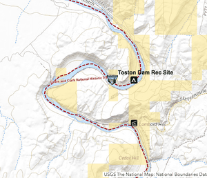
Toston Dam: 46°07′11″N 111°24′30″W
Facts and stats: (https://en.wikipedia.org/wiki/Toston_Dam)
The first dam you will encounter after departing Three Forks is located downstream of Headwaters State Park about 23 miles.
One can typically arrive there after 3-6 hours of leaving Three Forks. Camping is allowed at the camp at primitive sites; there are vault toilets, picnic tables, and the lower-downstream site has fire rings. There is no cell coverage there.
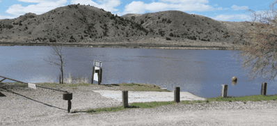
Photo of the take out ramp at Toston Dam. Camping is allowed in the grassy area near the ramp. If you decide to portage, there is a good dirt road that takes you below the dam 1/4 of a mile to the lower boat ramp and camping sites. Paddlers have camped above and below or even proceeded on once portaging rather than camp. You can do the entire portage and reload your boats probably in 1 hours time.
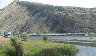
Looking downstream at the dam from the ramp and camping area.
Downstream view of the dam. From this viewpoint, the lower ramp is about 1/5th of a mile downstream along the dirt road. Just below this view location, there is a primitive trail that leads to the river that some paddlers have chosen to launch from there. It is very steep and rocky and not easy, but doable.
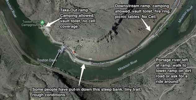
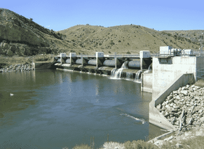
Above is a aerial view of the ramps, dam and dirt road to portage on.
Since there is no cell coverage, if you have an emergency,
there are often workers at the dam who can help out.
Since there is no cell coverage, if you have an emergency,
there are often workers at the dam who can help out.
Canyon Ferry Dam - Shannon Boat Access:
The 2nd dam on the Missouri is at the end of Canyon Ferry Lake, which can be a challenge in of itself. The Mileage from Toston Dam to Shannon Boat access for Ferry is about 45 miles. It often takes paddlers several days to cross Canyon Ferry Lake due to rough seas and high winds.
You will want to take out at the Shannon Boat Access (46.65069, -111.71581) on river (lake) right/east side, and not get anywhere near Canyon Ferry Dam. Most paddlers hug the west/left shore of the lake until they reach Schooner's Bar and Yacht Club at the end of the lake on the west side. Once there, they cross over the lake if conditions allow over to the Shannon Boat Ramp to begin their portage up the road to the lower campground.
If you have a local connection for a river angel to help with your portage, then the Bar and Yacht Club is the better place to take out. Portaging by road from the Bar to the lower campground and ramp is NOT advised as the road is narrow with a lot of traffic. Stay clear of the dam, there is no portage trail near the dam.
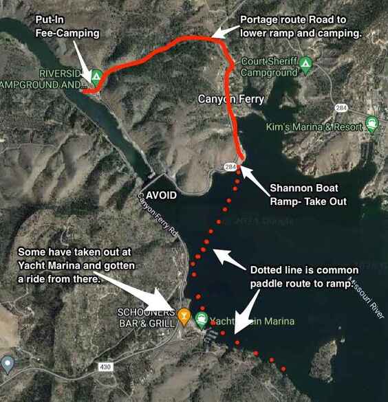


Photo's above: Left: Shannon Boat Launch take out view looking south/upstream on Canyon Ferry lake. Middle photo is an aerial view of the take-out and put-in location and looking south upstream on the lake. The right image is a view of the dam from the campground and put-in. The camping is first come and there is a substantial fee. Fee paddlers stay there once they make the portage. There is cell, plug-ins to recharge, water, toilets and access to people if you need a ride to Helena for any supplies. The portage of Canyon Ferry Dam could take over an hour.
Hauser Dam: 46°45′55″N 111°53′13″: The 3rd dam you will encounter is Hauser Dam, approximately 15 miles below the put-in at Canyon Ferry. There are places to stealth camp before, a fee camp at Black Sandy Beach or Black Sandy State Park on the west/left side before the dam.
This dam has been a bit of a challenge on occasion for some paddlers. North Western Energy who runs the dams, is suppose to provide help in portaging for paddlers.
In an ideal situation, you take out at the access location above the dam--river right, along a rock wall between the dam and employee housing. At the employee housing area you may find someone with an ATV or vehicle to help haul your gear down the road and across the dam to the ramp area below on the left side (west). It is required by them. However a few paddlers were unable to get help and had to manually haul their gear and boat across the dam. A few times, nearby river angels helped them with this portage. This is not a difficult portage and most likely will take you under 1 hour total to complete (unloading, portaging, and reloading boat). This is the ONLY dam until Gavins Point (the last one in Yankton), that you will actually cross over using the dam headwall to get to the opposite side.
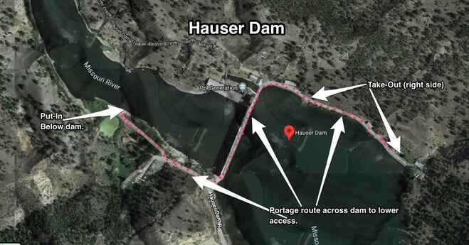
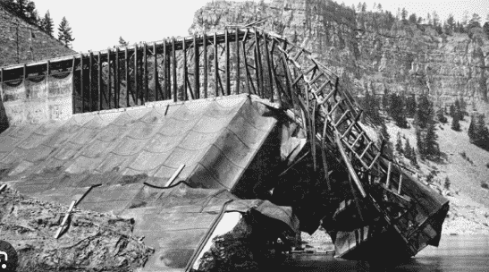
The first dam broke in the 1908 and sent a 70 foot wall of water downstream. This is the second dam. If the day is young and you portage early, you may be able to reach the "Gates of the Mountains" before your next camp. Just downstream of Hauser dam there is a few small potential areas to camp before you start seeing houses. I would allow a couple of hours to get into the "Gates", so plan accordingly. Dam stats and info here.
Below: Images of Hauser dam.
Below: Images of Hauser dam.


Holter Dam: 46°59′30″N 112°00′21″W: From Hauser dam, through the Gates of the Mountains to Holter dam is about 26 miles. This is the last dam until you reach Great Falls, Montana. Many paddler spend a little extra time between Hauser and Holter dams since this is one of the most scenic sections of the entire Missouri River. Meriwether Lewis named it "The Gates of The Rocky Mountains". There are many beautiful places to camp along this section including the Colter Campground which has vault toilets, picnic tables, as well as primitive sites with no amenities.
If you are interested in taking in a side hike, then don't miss Mann Gulch. This is the location of the tragic forest fire that killed 13 fire fighters. This event was made famous in the book entitled, Young Men and Fire (1992) by Norman Maclean. It is highly recommended that you read this book before the hike so you can understand how the event unfolded.
If you are interested in taking in a side hike, then don't miss Mann Gulch. This is the location of the tragic forest fire that killed 13 fire fighters. This event was made famous in the book entitled, Young Men and Fire (1992) by Norman Maclean. It is highly recommended that you read this book before the hike so you can understand how the event unfolded.
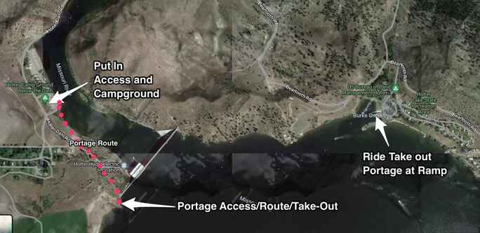
Above: Holter dam and the portage route. If you do a manual portage, take out on the left/west end of the dam. There is a sign that says, "Portage", at the take-out. From there, a small trail takes you down to the lower campground along a fairly good trail. You can do this portage manually without a cart, or use a cart. If you prefer to get a vehicle portage around the dam, then take out at the campground and boat access site on the right/east side. From there, it is a short drive to the access below the dam.
Below: Photos from Mann Gulch, including historic images from the 1949 tragedy. There is a stone marker/cross where each man was found engraved with his name.


|
|
Left: Forest Service documentary on the Mann Gulch tragedy of 1949. |
|
Left: Cold Missouri Waters by James Keelaghan Amazing tribute song to this tragic event sung from the view of Wag Dodge, one of the survivors. |
|
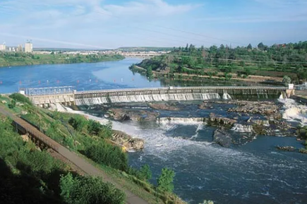
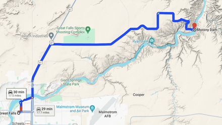
Great Falls: Black Eagle Dam, Rainbow Dam, Cochrane Dam,
Ryan Dam and Morony Dam:
From Holter dam to the city of Great Falls is about 90 river miles. The Missouri River below the city has 5 hydroelectric dams which have caused the major water falls that once existed to be submerged by the back waters of the dams. It took the Lewis & Clark Expedition two weeks to portage their gear around these waterfalls, and another 2 weeks exploring the region.
Arriving to Great Falls requires a little bit of thought and preparation. You don't want to arrive at the ramp late at night expecting a place to camp or someone to portage you around. You must plan ahead! The last 10-miles of the river as you approach Great Falls are lined on both sides with expensive residential homes. So think ahead if it is late in the day. You don't want to have to knock on someone's door and expecting them to let you camp in their yard because you didn't allow enough time to reach town. Most paddlers will stop before that last 10 miles and stop before there are houses, and make their final camp. That way, they have all morning to paddle those last 10 miles and arrive mid day. This will allow you time to either organize and prepare for someone to get you, load up, and drive you to the access ramp below the dams.
Many paddlers will often layover a day or more in Great Falls. It is the largest town they will encounter until they reach Bismarck, N.D. There is no camping directly at the Take-Out Portage ramp in Great Falls, unless you paddle a short ways up the Sun river about 3/4 of a mile past the bridge. The Sun River RV park has 20 tent sites. The access is not ideal, but it has worked for paddlers in the past who didn't have other options for camping or lodging.
If you opt to grab a hotel for the night, there is one directly at the top of the portage ramp! The LaQuinta by Wyndham of Great Falls has helped paddlers by providing a ground floor room with a place to store their canoe in a secure area. Contact them ahead of time at 406.761-2600 for a reservation. Plan ahead when nearing Great Falls. It can be a lot of work! If you're planning a river angel to help you with a ride, make sure you contact them several days ahead of time. They are not waiting around for you to arrive all week with binoculars and a lantern on the rivers edge. Call them well in advance!
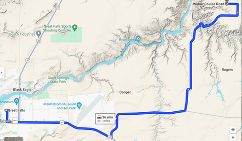
Most paddlers opt to get a ride from Great Falls to either Carters Ferry or Widow Coulee --below the last rapids and dams. The section of river between the upper and lower dam is 18 river miles. If you were to do a manual portage by cart and walk---Lewis & Clark style, it involves a serious commitment and effort, but the rewards are great! The road walk portage from Great Falls to Widow Coulee is 24 miles. It basically follows the original route that the L&C expedition took in 1805. The first 13+ miles is along a paved route that takes you through the busy streets of Great Falls and past the Air Force Base. The remaining 11+ miles is along a dusty and sometimes muddy dirt road along large tracts of private ranch land. It will most likely take you two whole days to complete this walk. In 2012, Canadian Rod Wellington took this route, hauling his kayak for two days, in 85F degree heat and dusty roads. Wellington camped one night along Salem Road on his way to Widow Coulee. Sometimes, after long periods or rain, the last several miles are nearly impassable due to mud.
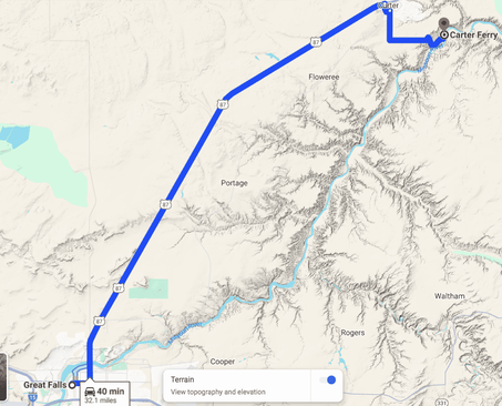
If you decide to put-in at Carters Ferry, the distance is 32 miles. You would need to travel along Highway 87 for 26 miles to the town of Carter. From there, you would walk 5.6 miles along a dirt road to Carter's Ferry. Highway 87 is a busy road, extreme caution must be taken. If you decide to get a ride by vehicle, it will take about 50 minutes of travel time. From Carter's Ferry, it is a 4-6 hour paddle to Ft. Benton. A few paddlers opted to get a ride all the way to Ft. Benton eliminating some of the logistics of putting in at Carter's Ferry. This means you will skip a total of about 45 river miles of the Missouri River from Great Falls. Putting in at Carter's Ferry, you only miss 18 river miles.
It is NOT recommended, but several long distance paddlers that have extensive whitewater paddling experience, are good at reading rivers, scouting rapids and are efficient technical paddlers, have put-in below Morony Dam. This is the last dam in this series of 5-dams. Below Morony dam, there are 4 major rapids that can be life threatening if you are inexperienced. If you are an experienced whitewater boater, and decide to put-in below Morony, the portage distance is almost 18-miles. The basic route is staying river left and scouting all rapids before paddling through. Paddlers Lisa Pugh, Al Louis, Kris Laurie, Craig Swanson, Allen Palmer, and a few others have paddled this section during their journey to the Gulf of Mexico. Bruce "Buck" Nelson paddled upstream through all of the falls and dams to Great Falls. In summary, you may find it easier to have a vehicle drive you around the dams.
(Photos below by Lisa Pugh, Rod Wellington, and L&CTHF)
- Link to Buck's Upstream Portage of Great Falls w/photos. LINK
(Photos below by Lisa Pugh, Rod Wellington, and L&CTHF)


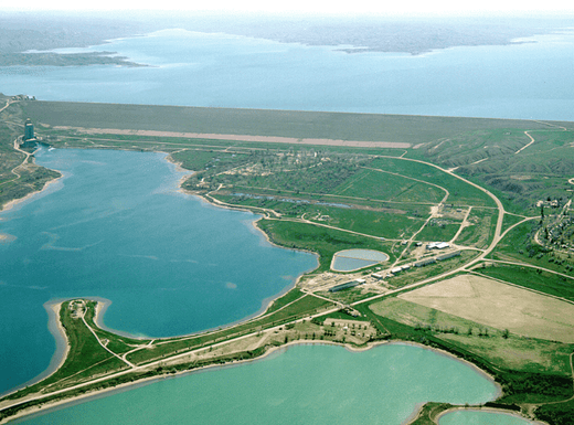
Ft. Peck Dam:
48°00′10″N 106°24′58″W
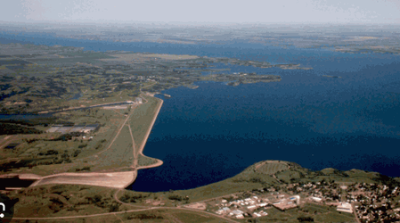
At 21,026 feet (6,409 m) in length and over 250 feet (76 m) in height, it is the largest hydraulically filled dam in the United States, and creates Fort Peck Lake, the fifth largest artificial lake in the U.S., more than 130 miles (210 km) long, 200 feet (61 m) deep, and it has a 1,520-mile (2,450 km) shoreline which is longer than the state of California's coastline.
Arriving at the dam after surviving what seems like an endless desolate reservoir is worth celebrating. Paddlers have been to the brink of mental exhaustion fighting violent storms, hail, relentless winds and huge seas. It can take 8-20 days to paddle from Ft. Benton to Ft. Peck dam. There are few road access points and no amenities along the way.
Many paddlers layover a day or more once they reach Ft. Peck Marina and Campground. Some have rented cabins near the marina and took advantage of regrouping after the long journey across the reservoir. There are no major food stores, so don't plan on doing a major resupply--the stores have a limited selection. The nearest grocery store is in Havre or Malta more than and hours drive by car. The folks at the marina and campground have been helpful in driving paddlers and boats to the lower access ramps when you put back in. If you decide to do it all on your own, the walk is several miles from the campground to the lower ramp on the west side of the river. There is a steep hill to descend from the town of Ft. Peck to the bottomland near the ramp.
48°00′10″N 106°24′58″W
At 21,026 feet (6,409 m) in length and over 250 feet (76 m) in height, it is the largest hydraulically filled dam in the United States, and creates Fort Peck Lake, the fifth largest artificial lake in the U.S., more than 130 miles (210 km) long, 200 feet (61 m) deep, and it has a 1,520-mile (2,450 km) shoreline which is longer than the state of California's coastline.
Arriving at the dam after surviving what seems like an endless desolate reservoir is worth celebrating. Paddlers have been to the brink of mental exhaustion fighting violent storms, hail, relentless winds and huge seas. It can take 8-20 days to paddle from Ft. Benton to Ft. Peck dam. There are few road access points and no amenities along the way.
Many paddlers layover a day or more once they reach Ft. Peck Marina and Campground. Some have rented cabins near the marina and took advantage of regrouping after the long journey across the reservoir. There are no major food stores, so don't plan on doing a major resupply--the stores have a limited selection. The nearest grocery store is in Havre or Malta more than and hours drive by car. The folks at the marina and campground have been helpful in driving paddlers and boats to the lower access ramps when you put back in. If you decide to do it all on your own, the walk is several miles from the campground to the lower ramp on the west side of the river. There is a steep hill to descend from the town of Ft. Peck to the bottomland near the ramp.
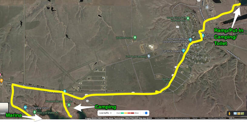
Above: The yellow line is the route from either the marina and cabins, or the campground to the lower access ramp below the dam. Your walk will take you through the small town of Ft. Peck, where many of the USACE administration buildings are located, and the Ft. Peck hotel which has a nice restaurant if you want to splurge a bit and get a good meal.
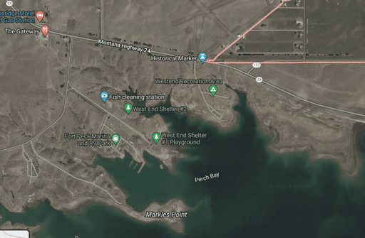
Left: Details of the Fort Peck Marina and RV park, Westend Recreation area campground. These locations are difficult to locate from the water as you paddle in. The shoreline all blends together.
Ft. Peck Marina Website (The Collingsworth Family are the owners and are very helpful.) Click
Westend Campground Information: Click
Ft. Peck Hotel & Bar & Grill: Click
Ft. Peck Marina Website (The Collingsworth Family are the owners and are very helpful.) Click
Westend Campground Information: Click
Ft. Peck Hotel & Bar & Grill: Click
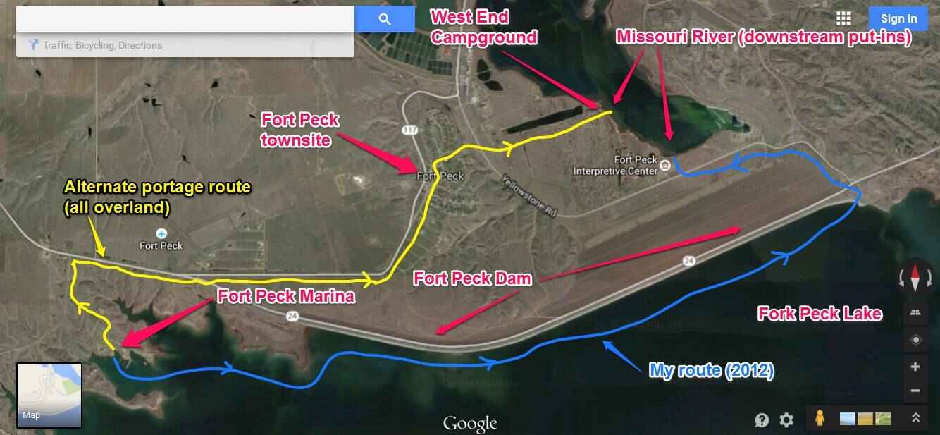
Above: Map above created by Rod Wellington and shows his 2013 route in blue around the dam. Rod paddled to the east end of the dam, took out at a dirt access road, then put-in near the Interpretive center. This is probably the shortest route, but you do miss all the amenities of Ft. Peck town.
CAUTION! Departure from Ft. Peck: Once you leave the dam, you will be passing through Ft. Peck tribal lands of the Sioux and Assiniboine nations. The tribal lands are along the north/left side of the river. There have been paddlers that have been assaulted, shot at, and harassed by members of the tribe. It is recommended that when you camp in the evening, you stay on the south/right side of the river and not within sight of anyone on the opposite sides. Being stealthy is your best friend. You will pass under two bridges, one at Wolf Point and the other near Poplar. Oft times members of the tribes in the late afternoon and evening like to party on the bridge, and have harassed paddlers and even shot at them. Plan ahead when going under these bridges. Early morning hours are best. It is not recommended going into the towns of Wolf Point, Brockton and Poplar, but to avoid. With that being said, there have been paddlers venture into town and had a wonderful time. Having the Tribal Police phone number on your speed dial may be helpful if you run into a situation. Their number is: (406) 768-2463 Tribal Website
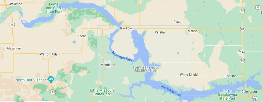
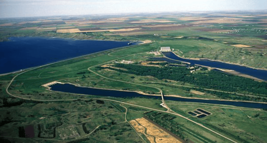
Garrison Dam- Lake Sakakawea-
North Dakota:
Coordinates: 47°29′55″N 101°24′43″W
This beast is an earth-fill embankment dam on the Missouri River in central North Dakota, U.S. Constructed by the U.S. Army Corps of Engineers from 1947 to 1953, at over 2 miles (3.2 km) in length, the dam is the fifth-largest earthen dam in the world! The distance for Williston, ND to Garrison dam on Lake Sakakawea is about 163 miles in length. Due to the wide open landscapes and ever present wind, paddlers will often have wind-bound days where no forward progress can take place safely. On average plan on taking 8-15 days to reach Garrison dam from Williston. It definitely can take longer as well as quicker depending on weather.
As you reach the Dakota's you enter Tornado Alley, all the way to St. Louis!
Map Below: Showing Lake Sakakawea from Williston, ND to Garrison Dam.
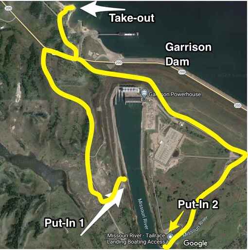
Garrison Dam & Portage: Paddlers typically take out to the right/west of the dam at either Sakakawea State Park or the Garrison Dam Take-Out/Boat ramp. The downstream Put-In is just below the dam on river right/west side (#1), or the Tailrace Landing Boat Access, river left/east side (#2). See map left. If you've made arraignments for someone to give you a ride, then meeting at the Take-Out or State Park would be ideal. You may want to use the campground as a layover location, or head downstream to avoid the crowds. If you have not made any arraignments, there is a good chance someone at the ramp with have a boat trailer or pickup truck that would be willing to give you a ride to the lower Put-In. If you plan to use your portage cart, the yellow route marked on the map below shows your two routes. Number #1 would be the shortest walk.
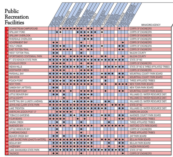
Diagram to the left may be helpful in showing what locations have water, access, cabin rental, picnic tables and vault toilets (tornado shelter). This also shows you where the crowds may be...to avoid.
Link to 68-Page digital file of the entire Lake Sakakawea. This file has details of every bay, landmark, access, campgrounds, mile markers and more.
A MUST have!
Click Image to the left to view and download.
Oahe Dam & Portage:
44°27′07″N 100°23′57″W
The Oahe Dam was authorized by the Flood Control Act of 1944, and construction by the United States Army Corps of Engineers began in 1948. The world's first rock tunnel boring machine (TBM) was invented in 1952 by James S. Robbins for the Oahe Dam project, which marked the beginning of machines replacing human tunnelers. The earth main dam reached its full height in October 1959. It was officially dedicated by President John F. Kennedy on August 17, 1962, the year in which it began generating power.
Once you leave Garrison Dam, the next dam you encounter is Oahe which is located in Pierre, SD, a distance of 220-miles. You will pass through Washburn and Bismarck, N.D., before you enter Lake Oahe. You may want to stop to resupply in these locations. Lake Oahe has tested many paddlers over the years. Expect wind, rain, hail and possible tornados.
Paddlers take on average 10-20 days to travel between Garrison and Oahe dam.
The Take-Out is located on river-right/west side before the dam. It is not marked very well, mainly a slopping ramp and parking area. If you have a ride around the dam, then this is a good location to meet them. If you plan to portage on your own with a portage cart, you will take out here and follow the yellow line on the map to the right to the Put-In below the dam. If you go past the Put-In, there is a fee-Campground there you may want to stay the night. The Capital city of South Dakota is just downstream on river-left/east. It will take you 1.5 hours to manually portage to the Put-In below the dam.
Click the image to the left to view and download the massive
USACE maps of the entire Lake Oahe reservoir. These maps show every mile, access points, campgrounds, towns, water locations and more.
A must have!
In addition to the above map, here is another map that will be helpful in showing overall features along Lake Oahe. Print this pdf file! Click Here
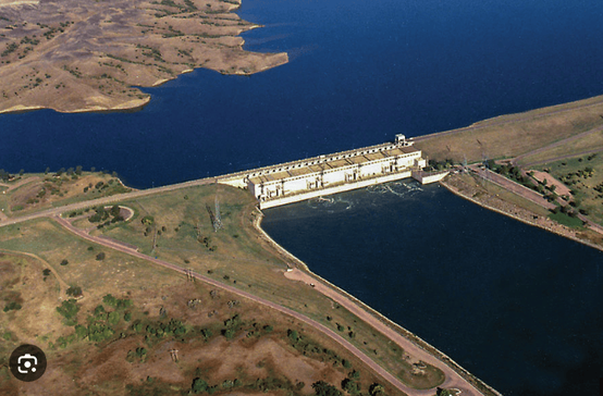
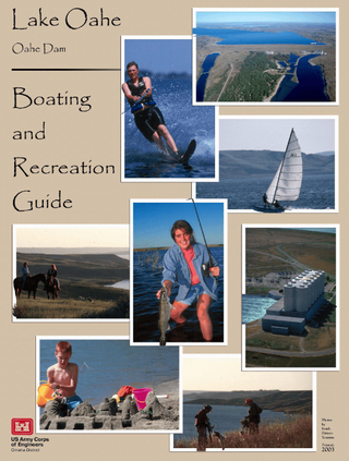
Lake Sharpe - Big Bend Dam:
& Portage
44.049473°N 99.448586°W
Located near Fort Thompson, South Dakota, just south of the Big Bend of the Missouri River, a large meander, Big Bend Dam creates Lake Sharpe, named after South Dakota Governor Merrill Q. Sharpe. The lake extends for 80 miles (130 km) up the course of the Missouri River passing through Pierre, the State Capitol. Lake Sharpe covers a total of 56,884 acres (23,020 ha) and drains an area just under 250,000 square miles (650,000 km2).
From Oahe dam in Pierre, S.D, Lake Sharpe is approximately 84 miles and has one of the shortest portages. The ramp access is on river-right/west side before the dam and slightly tucked into a bay.
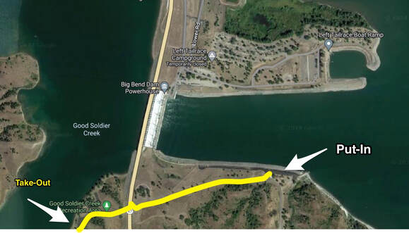
From the Good Soldier Creek access site follow the dirt road out of the parking lot going across the main road that crosses the dam. From there, the road slopes down to the river to the lower Put-In location. One can easily portage by cart in under an hours time. If you have arranged for a vehicle pick-up, the Good Soldier Creek access ramp is the ideal place.
See the map to the right.
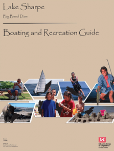
Lake Sharpe - Big Bend Dam Boaters Guide:
Click on the image to the left to view and download the massive boating guide for Lake Sharpe. This detailed map list every mile, access points, camping, Lewis & Clark camps, water sources, safety and more. A must read!
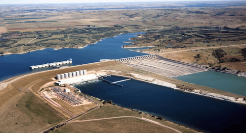
Ft. Randall Dam- Portage Route
Lake Francis Case,
Pickstown, S.D.
Fort Randall Dam is a 2.03-mile-long (3 km) earthen dam which spans the Missouri River and impounds Lake Francis Case, the 11th- largest reservoir in the U.S. Fort Randall Dam was authorized by the Flood Control Act of 1944 and plays a key role in the Pick–Sloan Plan for development of water resources in the Missouri River basin. The U.S. Army Corps of Engineers began construction of the dam in 1946, and was the first Pick-Sloan dam completed by the Omaha District. President Dwight D. Eisenhower threw the switch that started the first power generating unit in 1954.
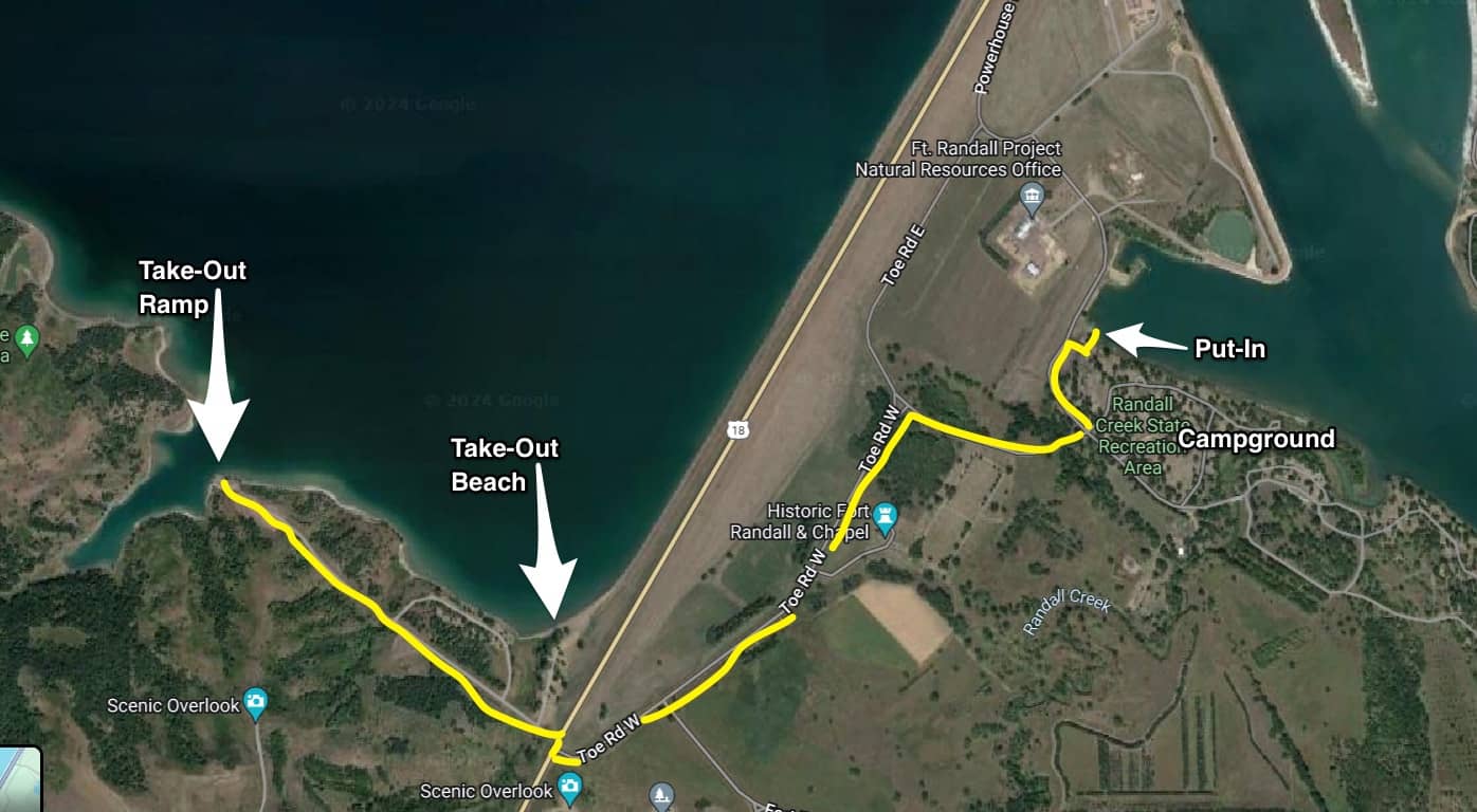
If you are portaging Ft. Randall dam, exit the river/Lewis & Clark Lake before the dam on river right. Welcome to Nebraska! If you are planning on doing a manual portage with a cart, it is recommended to get out at the right edge of the dam.
There is a swimming beach, parking and toilet, and it allows for a much shorter walk to the Pit-In/access below the dam.
Note the map below, showing the boat ramp and the beach. If you are planning on getting a ride by vehicle, then take out at the access ramp and not at the swimming beach, as it will be easier to load up a vehicle here, rather than the beach. From both the ramp or the beach, travel to the main road (Hwy 18), turn right ONLY for about 40 feet, then take a left/east onto the secondary Toe Road W. This is a sloping decline. The road will take you to a large campground with showers, water, picnic table and power outlets to recharge your batteries.
The camping is a fee campground, reservations required. It may be worth the layover. A few of the Missouri River Paddlers live in nearby Pickstown, S.D., and may be able to help you with a resupply or getting a burger and cold beer.
The actual Put-In is upstream of the campground closer to the dam.
In 2022, the Missouri River Paddlers staged their 2nd Rendezvous at the Campground,
with nearly 100 paddlers from all over the US attending.
The campground manager may let you camp in your own location near the picnic area and avoiding the campground at no-charge. You will have to make those connections ahead of time. If they know what you are doing , they most likely will help you out. If you decide to press on, there are some nice stealth camping locations downstream on the many sandbars and islands.
It is very beautiful in this area.

Click the USACE logo to the left to view and download the
Recreational Boaters guide and map of the entire Lake Francis Case Lake
and Ft. Randall Dam.
This is a great resource!
Recreational Boaters guide and map of the entire Lake Francis Case Lake
and Ft. Randall Dam.
This is a great resource!
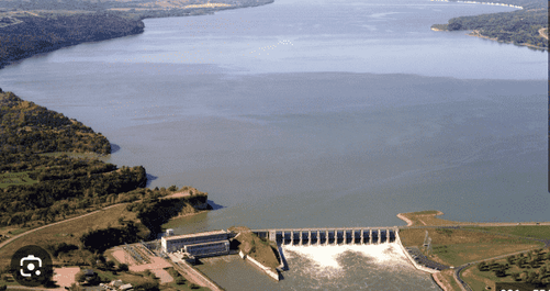
Gavins Point Dam/ Lewis & Clark Lake
Yankton, S.D.
Portage
Gavins Point Dam was constructed as a part of the Pick–Sloan Missouri Basin Program, authorized by the Flood Control Act of 1944 by Congress. The dam is named after Gavins Point, a bluff along the northern bank of the Missouri River named for an early settler, now within the western end of Lewis & Clark Recreation Area, which was to be the original location of construction of the dam. The location was moved and construction began further downstream along Calumet Bluff because this location offered a shorter span distance and less fill material needed for dam construction, although the project kept the original name. The dam is a 1.9-mile-long (3 km) embankment rolled-earth and chalk-fill dam which spans the Missouri River and impounds Lewis and Clark Lake. The dam joins Cedar County, Nebraska with Yankton County, South Dakota a distance of 811.1 river miles (1,305 km) upstream of St. Louis, Missouri, where the river joins the Mississippi River.
Portage: Congratulations, this is the last dam on the Missouri river system!
Reaching Gavins Point dam is a milestone on your decent of the Missouri river. Paddlers, spend weeks paddling the big reservoirs of the Dakota's and Montana, and are now on the free flowing Missouri once again after they portage this dam. It's important to talk about Lewis & Clark lake before the portage route is discussed. It is recommended that you stay river left/north along L&C lake for your last day or so. Once you cross under Hwy-14 near Running Water. This bridge will take you one long day from the previous dam--Ft. Randall to reach, or it may take you more than one. There are plenty of beautiful beaches, sand bars and islands to camp on. The ramp/access at Running Water (river left) is a nice stop if you want to stretch your legs. From here, the river channel crosses over to the Nebraska side towards a series of bluffs. As you paddle along these bluffs, be on the look out for a channel near some islands that heads off to the left/west toward the town of Springfield. This is the channel you will want to take! If you miss this channel, you cannot reach Springfield, nor the north/left shore and will be forced to follow the south/right shore along Nebraska. This route is fine to take , you will need to figure your own strategy for arriving at the dam and portage. The channel to Springfield is straight forward. You will see the buildings and water tower long before you arrive there. The sediment has filled in L&C lake so much, that many of the islands are impossible to get on and are covered with tall grass. In some ways you will feel like you are traveling through a tunnel. Once you reach Springfield, there is a boat access ramp, shelter and vault toilet. During the 2022 Missouri River Paddlers Rendezvous, they were allowed to camp there as a group. The town is very paddler-friendly and you are welcome to pitch a tent there as well. The town sits high on the hill above and is a short walk to a few burger and cold beer options, but well worth the hike.
From Springfield, just stay along the left shore all the way to the Campground, marina and dam area. If the weather and wind are in your favor, you can reach the day after about 8 hours. There are not a lot of options if you have to bail out sooner due to wind and waves, so looking over this section on Google Earth may be helpful. There are some beautiful bluffs along this sections before you begin to see the busy dam area. The Lewis & Clark State Park/Campground will appear on you left. There are hundreds of sites here if you decide to camp, but you must make a reservation online! If you have a prearranged ride around the dam, they can meet you at the end of the campground area or just beyond at the Marina. This is a busy are with motor boat activity, so be cautious. The 2-maps below will show you the area described.
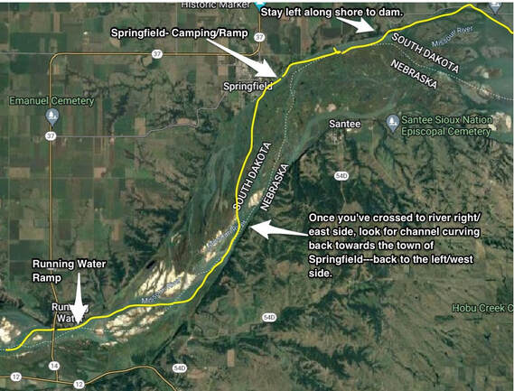
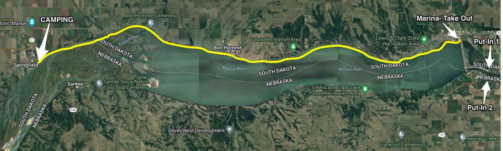
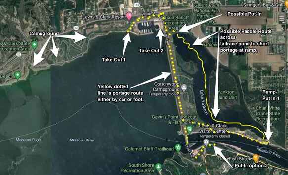
The Portage:
If you have a prearrainged ride around the dam, you should use "Take Out 1, or Take Out 2" options shown on the map to the left. One is a ramp just beyond the campground, the other is the marina. If you have someone to give you a ride, don't worry about the directions, they will know where to reach the access locations below the dam.
If you are planning to do a manual portage with a cart and walk, this will take some thoughts regarding timing and strategy where to put back in. This is a busy area, so the road walk will have lots of traffic to be aware of. This won't be a quick portage so consider the time of day you are arriving. If it's evening, then you might be putting back in and finding a camp location downstream in the dark. There are a couple of options where to Put In below the dam, depending on how far you want to walk and if you want an easy route or more challenging. The most straight forward and safest most likely is the Ramp Put-In 1 shown on the above map. Note the dotted yellow line going from the campground/marina area, across the dam headwall to a road just before the actual dam. This road descends down a steep slope to the lower road, where it eventually reaches the lower boat ramp.
If you don't want to "walk" as much, there is an option of taking the first road to the left as you begin to cross over the dam headwall. It descends down to Lake Yankton (tailrace pond) which is part of the original river channel before the dam was built. You can put your boat in where it says, "Possible Put In", on the map above. From there, paddle the few miles across the lake shown by the yellow line on the map above. It appears that this lake extends all the way to the lower river, however it does not. You will have to get out and portage less than 100 feet over the road and down to the ramp where it says, "Ramp Put In 1" on the map above. This route may take you far less time than walking along a busy road. Another option is to go across the dam to the Nebraska side, and down an access road to a lower ramp. There was a tiny campground with about 5 sites that makes it convenient for paddlers if you decide to camp there. You may want to inquire with the state park people, as that whole side of the river may have changed. This entire portage mentioned above could take a couple of hours.
From either Put-In, the town of Yankton is about 4 miles downstream.
Click the image to the left to view and download the file ---
Lewis & Clark Lake and Gavins Point Dam Boating and Rec Guide. This is a huge file with detailed maps and information regarding camping, paddling, safety and more.
- Also: Aerial Photos of Ft. Randall Dam to Santee NE: File: HERE
- Aerial Photos of Gavins to Ponca State Park File: HERE